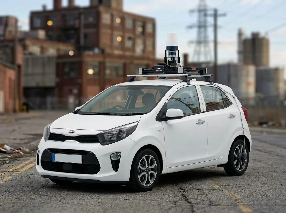
Drive past a survey vehicle and you will notice the roof first. A spinning cylinder, a camera, a mast with boxes stacked on it, and a couple of units nobody has labeled for you. It looks like a lot of hardware for the job of driving down a road.
It is. But the job is not driving down the road. The job is producing a measurement of the road that is accurate to a few centimeters, in a known coordinate system, with a timestamp on every point. Each sensor on that roof contributes one part of that measurement, and none of them can produce it alone.
The map is only as good as what was measured
An HD map describes the world a vehicle is going to trust with its own position. Lanes, stop lines, and curbs are drawn on top of a point cloud: a dense set of 3D measurements of the surfaces around the vehicle. That cloud is the reality layer. Everything the planner knows about the site traces back to it.
If the cloud is wrong, the map is wrong in a way that still looks right. The geometry renders cleanly. The curb is there. It is just a few centimeters from where it actually is, and nothing on the screen tells you so.
Our last post made the point that a coordinate is an agreement about where, when, and relative to what. The sensors are where that agreement gets its numbers.
Five sensors, five questions
Each sensor answers a different question.
| Sensor | What it contributes |
|---|---|
| 360 degree mechanical LiDAR | The structure: distance to every surface in a full circle |
| GNSS | An absolute position on the WGS84 ellipsoid, many times a second |
| IMU | Acceleration and rotation at hundreds of hertz, to carry the pose between fixes |
| Wheel encoder | Distance traveled, counted from wheel rotation |
| Camera | Color and meaning, so a human can tell a dock face from a sign |
The LiDAR is the only one of the five that measures the world. Everything else on the roof exists to say where that measurement was taken from. The Sensor Suite chapter of the HD Map Handbook takes each one apart, including how it mounts and what it is prone to getting wrong.
Other common sensors
Not everything mounted on a vehicle is there to build the map.
A frequency-modulated continuous-wave LiDAR, or FMCW, measures range and radial velocity in the same shot, so it knows how fast each surface it can see is moving toward or away from the vehicle. A 360 degree Doppler radar measures how fast everything around it is moving, and it keeps working through dust and rain that blind optical sensors. Neither changes the shape of the cloud. Both are built for perception, which asks what is out there and what it is doing.
You meet the same question on vehicles that are not survey vehicles at all. A surround-view camera rig is usually four wide-angle units aimed front, rear, and to each side, stitched into one image for parking and low-speed maneuvering. Ultrasonic sonar rings the bumpers of most new cars, measuring a couple of meters to the nearest obstacle.
The dividing line is not the type of sensor. A camera can build a map and a camera can be a parking aid, and the difference is what the individual unit was chosen and mounted to measure. A survey camera is calibrated, triggered, and stamped so that its frames can be draped onto the cloud. A parking camera is wide-angle, low-resolution, and read by a stack that only needs to know whether something is behind the car.
So the question to put to any piece of hardware on a vehicle is what it can change. A sensor that measures geometry and time changes the shape of the cloud, and it belongs in the mapping pipeline. A sensor that measures velocity, or that exists so the vehicle can understand what it is looking at, belongs on the vehicle that consumes the map.
No single sensor is enough
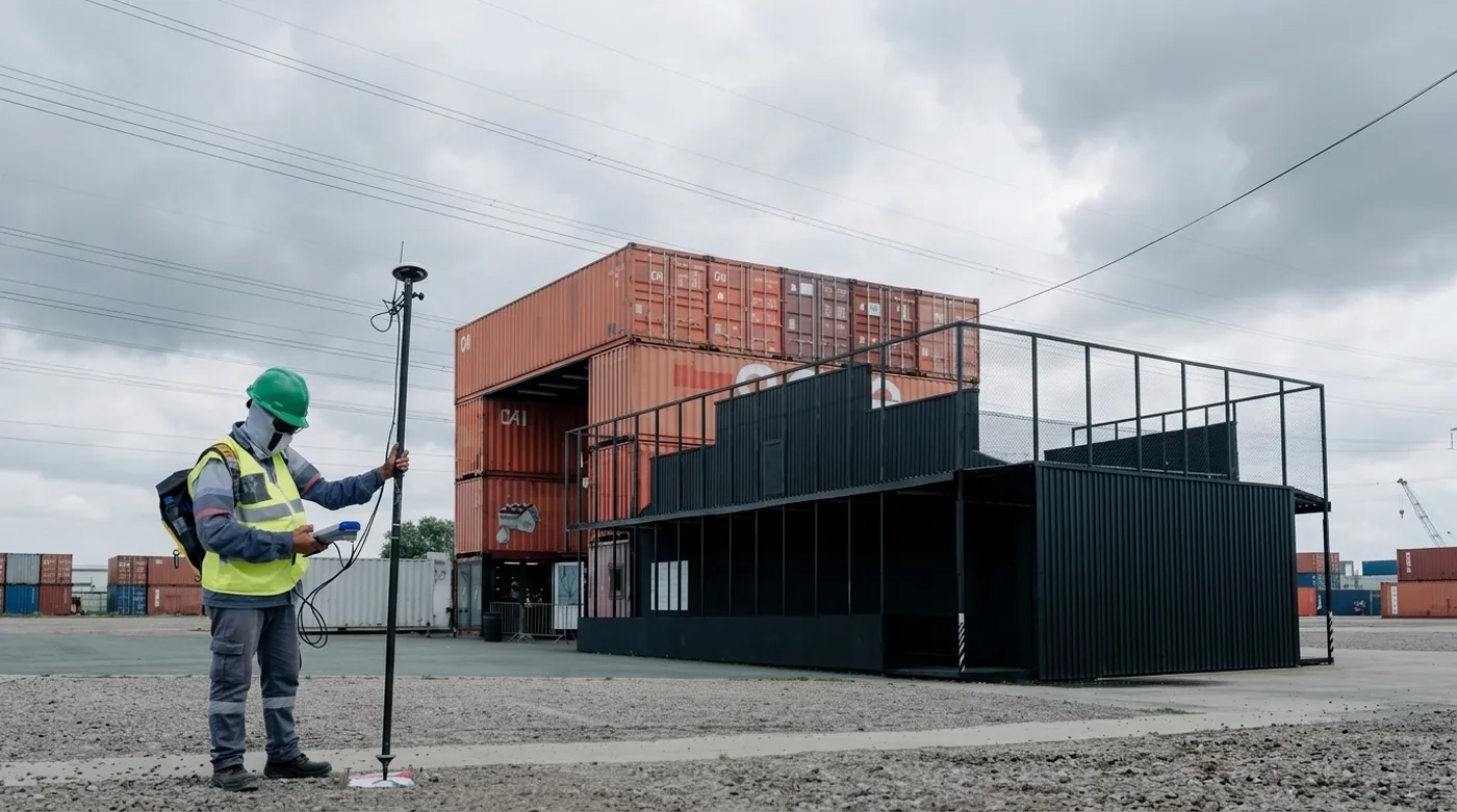
GNSS is the only absolute reference on the rig and the least dependable one on its own. It wanders, it reflects off container stacks, it vanishes under a gantry, and none of that announces itself. The wheel encoder is the cheapest thing on the vehicle and the easiest to fool: change the tire and the odometry becomes a plausible lie.
So the rig trusts none of them alone. It fuses them into a single trajectory. GNSS anchors that trajectory to the Earth, the IMU carries it between fixes, the wheel encoder constrains how far it has gone, and the LiDAR scans line up with each other and with the structures they describe. The accuracy comes from the fusion. No individual sensor provides it.
Why the fusion works
The sensors fail in opposite directions.
The IMU is at its best across a tenth of a second and at its worst across ten seconds. It measures acceleration, and acceleration has to be integrated twice to become position, so a small bias in the reading compounds into an error that grows with the square of time. Nothing inside the IMU reports that it has drifted. GNSS is the mirror image: noisy across a tenth of a second, bounded across ten minutes. It never runs away. It only wanders.
Together, each covers the other’s worst frequency. That is what a Kalman filter does: predict with the fast sensor, correct with the slow one, and weight each by how much it is trusted. The LiDAR carries the heaviest weight in that sum, not because it is truer than the others but because it is tighter. A measurement that repeats to a centimeter earns a heavier vote than one that repeats to a meter.
Your body already runs this rig. The inner ear’s semicircular canals are rate gyros, and its otoliths are accelerometers that cannot separate tilt from acceleration, the same ambiguity an IMU has to resolve before it can say which way is up. Proprioception, the sense of where your limbs are without looking at them, is wheel odometry: it reports your own body, not the world. Vision reports on the world. Your brain combines the three by relative trust, which is the same arithmetic, and the demonstration is standing on one foot with your eyes closed. Take away the visual correction and you sway, because the inner ear drifts on its own.
Heading is the hard one
GNSS is strongest at position and weakest at heading. A single antenna infers heading from successive positions, which is noisy and gets worse as the vehicle slows, exactly when a survey vehicle is maneuvering. Two antennas on a known baseline measure it directly, which is why a survey-grade receiver carries two.
The arithmetic says why it earns the second antenna. A tenth of a degree of heading error displaces a point 100 meters from the vehicle by 17 centimeters, and a point a kilometer out by 1.7 meters. Heading is the one error on the rig that grows with distance. Position error does not: a two centimeter GNSS error is two centimeters everywhere, near and far.
So the two sensors divide the job by range. GNSS holds position, which is bounded and does not care how far away the geometry sits. The LiDAR holds heading, because it sees structure at close range in every direction at once, and matching a wall or a curb edge pins orientation far more sharply than a satellite fix can.
That is also why a few widely spaced fixes anchor a whole site. A fix resets position outright, however far the drive wandered since the last one. Keeping orientation from fanning out in between is the LiDAR’s job.
The rig is an instrument
Two more things have to be right before any of that holds on a moving vehicle, and neither of them is a sensor.
The first is the clock. A mechanical LiDAR takes a tenth of a second to spin once, and the vehicle travels the whole time it is scanning, so a scan is not an instant. Every point carries its own timestamp, and registration places each return at the pose the vehicle held when that point was measured. Treat the scan as one moment instead and the cloud smears, first on poles and curb edges, which are the features the map is built from.
The second is the origin. Each sensor measures in its own frame, and every frame sits somewhere else on the vehicle. The rig resolves that with one reference frame, base_link, on the ground midway between the rear wheels, and one calibrated relationship from base_link to each sensor. Compose every pair through that origin and remounting a single unit costs one calibration rather than every pair it appears in.
The Sensor Suite chapter works through both in full, along with the mounting geometry and the three things that most often go wrong: shutter timing, LiDAR design, and per-point timestamps.
From drive to reality layer
Put it together and a drive becomes a registered point cloud: a georeferenced, timestamped surface measurement that every later step draws on. On the Harbor Yard loop road, the curb along the container zone and the paint at the gate are traced from the same cloud. The planner routes across it.
Get the rig right and the cloud is a faithful record of the site. Get it wrong and the error travels with it, showing up later as a lane that sits slightly off the paint.
If you are building a map for a site and want the reality layer done properly, get in touch or take a look at Veer Studio.